Stonecutters’ Route
ROUTE CHARACTERISTICS
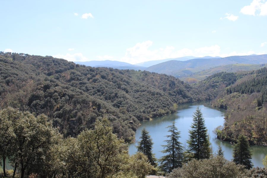
- Trail Overview: The route follows a towpath along the Boeza River, offering a comfortable and scenic walk surrounded by poplars, oaks, and chestnuts.
- Length and Duration: Approximately 9 kilometers one-way, with an estimated duration of 2 hours.
- Difficulty: Considered a medium-difficulty route, suitable for both hiking and mountain biking (100% rideable).
- Points of Interest: The trail connects the center of Ponferrada with the outskirts, passing near the old Montearenas quarries and ending at San Miguel de las Dueñas.
📍 Location & Contact
- Starting Points in Ponferrada: A common option is near the Puente Boeza or the area known as "el Caminín". Directions:
- Look for the Glorieta del Cine and take Avenida del Castillo.
- Turn onto the second street on the left (el Caminín) and continue until the asphalt ends.
- Follow the track parallel to the train tracks until you find the trailhead.
- Starting Point from San Miguel de las Dueñas: The route can also begin from the other end. Detailed tracks are available on platforms such as Wikiloc.
- Coordinates: The trail does not have a single coordinate as it stretches between Ponferrada and San Miguel de las Dueñas. Approximate key points:
- Ponferrada Start (near Puente Boeza / "El Caminín"): 42°32'49.0"N 6°34'50.0"W (42.546944, -6.580556)
- San Miguel de las Dueñas End: 42°30'40.5"N 6°31'00.8"W (42.511250, -6.516889)
- Website: The Senda de los Canteros has no official independent site, but information is available on official tourism portals:
- Ponferrada City Hall (Tourism): https://www.ponferrada.org/turismo/es/rutas/senda-canteros
- Turismo Ponferrada: https://turismoponferrada.com/que-te-ofrecemos/rutas/ruta-de-los-canteros/
- Hiking Platforms (Wikiloc/AllTrails): Detailed GPS tracks available.
- Phone:
- Ponferrada Tourist Office: +34 987 42 42 36
- Ponferrada City Hall: +34 987 41 50 00
- Social Media: The trail has no own accounts, information is shared via official tourism channels:
- Ponferrada City Hall (Tourism): Facebook: www.facebook.com
- Instagram: @turismobierzo
🗣️ Languages: The main language is Spanish. The trail has no staff; the Ponferrada Tourist Office also provides service in English. Bars and shops in Ponferrada and San Miguel de las Dueñas primarily serve in Spanish.
♿ Accessibility: The trail is not fully accessible for people with reduced mobility or wheelchair users. Although there are low-gradient sections, the route has irregularities and some narrow areas.
- Terrain: Mixed surfaces with forest tracks, winding paths, and rocky passages; some loose stones and river-adjacent sections require caution.
- Adapted chairs: In February 2024, an inclusive route used off-road adapted wheelchairs with support from experienced hikers. Standard wheelchairs cannot complete the trail unaided.
- Google indicates no accessible entrance or parking for wheelchairs.