Pilgrims’ Route
Ruta de Los Romeros – Bárcena Reservoir: An easy walk along the banks of the Sil River, discovering Roman heritage and views of the Bárcena Reservoir.
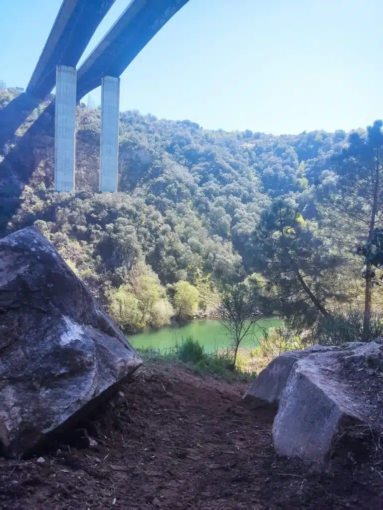
- Route: The trail runs along the left bank of the Sil River, offering a natural landscape with riverside vegetation and views of the reservoir. The path follows the course of an ancient Roman mining canal.
- Length and duration: The route is approximately 9 kilometers (round trip). Estimated duration is 3 hours, though it may vary depending on pace and stops.
- Difficulty: Considered a low-difficulty route, suitable for hiking, running, and mountain biking. It does not present significant elevation changes, making it accessible for most people.
- Points of interest: The route connects the center of Ponferrada with the surroundings of the Bárcena Reservoir, passing by the Azufre Fountain and the reservoir wall.
- Route start: The route can start from the parking lot of the Energy Museum in Ponferrada.
- Route end: The route ends near the reservoir, close to the dam or the Azufre Fountain.
- Circular route: Although the main route is round-trip, there are circular options combining the Romeros Path with other local trails, such as the Explorers and Stonemasons Paths.
INFORMATION
📍 Location and contact
- Address: There is no single postal address, as it is a public trail. However, a recommended starting point in Ponferrada is the Energy Museum parking lot (Avenida de la Compostilla, 24400 Ponferrada).
- Web:
- The Ruta de los Romeros does not have an independent official website, but information is available on several official tourism portals and hiking platforms:
- Green Ring of Ponferrada: https://anilloverde.ponferrada.org/project/ruta-de-los-romeros/
- Tourism Ponferrada: https://turismoponferrada.com/que-te-ofrecemos/rutas/ruta-de-los-romeros/
- Hiking platforms (Wikiloc/AllTrails) for GPS tracks.
- The Ruta de los Romeros does not have an independent official website, but information is available on several official tourism portals and hiking platforms:
- Phone:
- +34 987 42 42 36 (Ponferrada Tourist Office)
- +34 987 41 50 00 (Ponferrada City Hall: general or trail maintenance inquiries)
- +34 987 400 800 (Energy Museum: recommended starting point)
- Email:
- turismo@ponferrada.org (Tourist Office)
- info@museoenergia.com (Energy Museum)
- Social Media:
- Energy Museum (recommended start):
- Facebook: www.facebook.com
- Instagram: @museodelaenergia
- X (formerly Twitter): @MuseoEnergia
- Bierzo Tourism (Ponferrada City Hall):
- Facebook: www.facebook.com
- Instagram: @turismobierzo
- Energy Museum (recommended start):
🗣️ Languages attended: Spanish
♿ Accessibility: Ruta de los Romeros is not accessible for the general public with reduced mobility. For an accessible walk along the Sil River, consult the Green Ring sections best suited to your needs.
- Difficulty: Although easy and suitable for most people, the path is not always even, with dirt sections and irregularities that may hinder passage for those with reduced mobility.
- Terrain: The route follows the riverbank and an old canal, which may include uneven terrain or narrow passages.
- Inclusive use: Inclusive activities within the Green Ring may require all-terrain adapted chairs and volunteer assistance.
- Alternative options: The Green Ring offers urban and semi-urban accessible sections, such as the Boeza River path.
The Ruta de los Romeros is a natural trail with free and open access. / Possible associated costs (*)
(*) Transport: If you use any means of transport to reach the starting point of the route or to return.
Accommodation and meals: Expenses for lodging, food, or drinks in nearby towns, such as Ponferrada or establishments around the reservoir.
Equipment: Cost of acquiring or renting sports equipment, such as bicycles, if needed.
Visits to the Energy Museum: If you decide to visit the Energy Museum, which is the recommended starting point, there is an entry fee. General admission for exhibitions is €5 (reduced fee €3).
YOU MAY BE INTERESTED IN THESE
